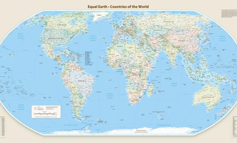
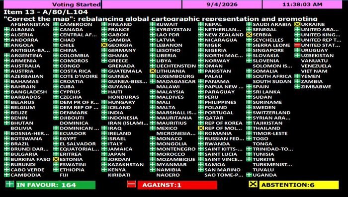
The United Nations General Assembly on Friday, September 4, adopted a resolution, initiated by Togo and supported by African countries, by 164 votes in favor, one against, and six abstentions, that promotes the wider use of the Equal Earth map to more accurately depict the areas of countries and continents.
The United States was the only country to oppose the resolution, calling it “an ideological agenda that distracts attention from the core issues of peace and international relations.”


The new resolution relates to criticism of the Mercator map, a map designed for maritime navigation since 1569, which shows areas near the poles larger than they actually are due to the way it depicts the Earth’s surface. Greenland appears to be about the same size as Africa, while Africa is about 14 times larger.
African countries say this visual distortion has created a false perception of Africa’s true location and size. The Earth map attempts to more accurately depict the relative size of the continents.
This resolution is not binding and does not prohibit the use of the Mercator map, especially in maritime and air navigation, but rather encourages countries, educational institutions, international organizations, and technology companies to use maps that more accurately reflect the actual area of the world’s regions.